List of candidate sites
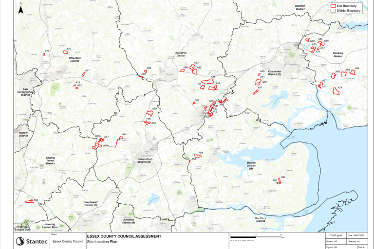
This map of Essex shows the candidate sites, marked in red.
The list below names all of the candidate sites involved in this review and consultation. You can click on a specific site for a summary of the report for this site.
To learn about the methodologies used and to read the full assessment, check the appendices to the assessment of sites.
Braintree
A6 - Bradwell Quarry (PDF, 1 MB)
A47 - Bradwell, Monk's Farm (PDF, 1.23 MB)
A48 - Bradwell, Grange Farm (PDF, 1.07 MB)
A50 - Colemans Farm, Appleford Farm Eastern extension (PDF, 1.05 MB)
A52 - Colemans Farm, Southern extension (PDF, 1.03 MB)
A54 - Whiteheads, Witham (PDF, 1.01 MB)
A83 - Colemans Farm, Hole Farm
A84 - Colemans Farm, Appleford Farm North Extension (PDF, 1.19 MB)
A89 - Covenbrooke Hall Farm (PDF, 1.1 MB)
A92 - Land at Pattiswick Hall Farm, Small Site (PDF, 1.03 MB)
A93 - Land at Pattiswick Hall Farm, Full Site (PDF, 1.12 MB)
A94 - Land at Highfields Farm (PDF, 1.15 MB)
D7 - Land at Pond Farm, transhipment site (PDF, 1.15 MB)
Chelmsford
A56 - Sheepcotes Western (PDF, 1.12 MB)
A57 - Chalk End, Roxwell (PDF, 1.04 MB)
A58 - Little Smiths, Danbury (PDF, 1.18 MB)
A59 - Lowleys Farm (PDF, 1.09 MB)
A60a - Shellow Cross Farm (PDF, 1.37 MB)
A60b - Shellow Cross Farm (PDF, 1.38 MB)
A91 - Land at Chignal St James (PDF, 1.09 MB)
Colchester
A31 - Maldon Road, Birch (PDF, 1.02 MB)
A61 - Heckfordbridge (PDF, 1.02 MB)
A62 - Heckfordbridge (PDF, 1.08 MB)
A94 - Land at Highfields Farm (PDF, 1.15 MB)
A95 - Land at Bellhouse Farm South (PDF, 1022.74 KB)
Epping
A63 - Patch Park, Abridge (PDF, 1.05 MB)
Maldon
A49 - Colemans Farm, Hill Broad Farm – full site (PDF, 1.08 MB)
A51 - Colemans Farm, Hill Broad Farm – north extension (PDF, 1.02 MB)
A58 - Little Smiths, Danbury (PDF, 1.18 MB)
A64 - Land East of Asheldham Quarry (PDF, 879.21 KB)
A65 - Land South of Asheldham Quarry (PDF, 827.29 KB)
A66 - White House Farm, Woodham Walter (PDF, 1.07 MB)
A82 - Colemans Farm, Elm Springs Extension (PDF, 1.14 MB)
A94 - Land at Highfields Farm (PDF, 1.15 MB)
Tendring
A67 - Church Farm, Alresford (PDF, 1.15MB)
A68 - Crabtree Farm, Great Bentley (PDF, 945.63 KB)
A69 – Frating Hall (PDF, 1012.41 KB)
A71 - Lodge Farm, Alresford (PDF, 1.12 MB)
A72 - Martells, Southern extension (PDF, 1.03 MB)
A73 - Martells, Western extension (PDF, 1.02 MB)
A74 - Thorrington Hall Farm (PDF, 1.3 MB)
A79 - Crown Quarry, North of Wick Lane (PDF, 1.06 MB)
A80 - Crown Quarry, South of Wick Lane (PDF, 1.05 MB)
A85 - Martells, North of Frating Road - East (PDF, 1.02 MB)
A86 - Martells, North of Frating Road - West (PDF, 1.1 MB)
A87 - Martells, East of Slough Lane (PDF, 1.05 MB)
A88 - Gurnhams Farm (PDF, 933.35 KB)
Uttlesford
A22 – Little Bullocks Farm (PDF, 941.54 KB)
A23 – Little Bullocks Farm (PDF, 981.01 KB)
A75 - Land at Orford, Ugley (PDF, 945.6 KB)
A76 - Elsenham (PDF, 992.18 KB)
A77 - Westward Extension to Highwood Quarry, Little Easton (PDF, 1.04 MB)